Britain is set to be hit by a ‘snow bomb’ just days after enjoying summery 23C temperatures, according to new forecasts. In a chilly turn, the mercury could plunge back towards freezing as soon as next week, with up to seven centimetres of snow blanketing some areas.
It comes despite weather forecasts showing the UK will be warmer than many popular holiday destinations this weekend, including Lanzarote, where maximum temperatures will reach only 22C on Saturday, and Crete, which will see highs of just 19C. However, the arrival of a new cold front is set to banish this hot spell, causing conditions to become dramatically cooler as we move further into April.
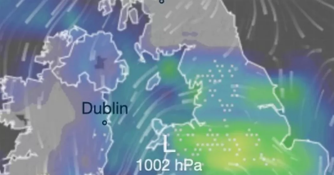
A new map from forecaster Ventusky shows Birmingham bearing the brunt of upcoming snowfall on Sunday, April 20, with up to 7cm forecast to fall over the city. Stoke-on-Trent, Leicester, Greater Manchester, Leeds, Bradford and some areas of the northeast also feature in the forecasts.
Parts of the East Midlands will also see some intense flurries, with five centimetres forecast to fall across these areas.
Temperatures in the affected areas will range between 0C and 3C, according to the maps.
The Met Office has meanwhile warned of a transition towards cooler and unsettled conditions expected from next week, including plenty of rain.
The warmest temperatures this weekend are forecast for London and the southeast, where highs of 23C are forecast on Saturday.
In Cardiff the mercury is forecast to rise to 19C, Edinburgh is set for 18C and a cooler 16C is expected in Belfast.
Drier conditions are expected to dominate at the start of the weekend, before wetter weather moves in from the north on Sunday.
Met Office Deputy Chief Meteorologist Mark Sidaway said: “The high pressure that has been responsible for our recent high temperatures gradually shifts away over the weekend, as more of an unsettled regime begins to take charge and introduces more frequent rain and cloud, as well as a drop in temperatures.
“Those in the far northwest will see the first of the rain late on Friday and into Saturday, and while Saturday will start dry for much of the UK, we are likely to see areas of showers moving in from the south later in the day, although this aspect is still quite uncertain. However, by Sunday fresher conditions with showers are expected to move in from the west.”
James Madden from Exacta Weather said a widespread “wintry blast” was likely towards the end of the month.
He wrote in a new forecast this week: “It will also begin to turn somewhat cooler and more unsettled during the latter part of this weekend and early next week for some, and this will have the potential to turn wintry across the highest ground in the far north of Scotland on Sunday and pave the way for a potentially potent wintry blast to include other regions just prior to the final third of the month and into and around late April”.
At Reach and across our entities we and our partners use information collected through cookies and other identifiers from your device to improve experience on our site, analyse how it is used and to show personalised advertising. You can opt out of the sale or sharing of your data, at any time clicking the “Do Not Sell or Share my Data” button at the bottom of the webpage. Please note that your preferences are browser specific. Use of our website and any of our services represents your acceptance of the use of cookies and consent to the practices described in our Privacy Notice and Cookie Notice.


