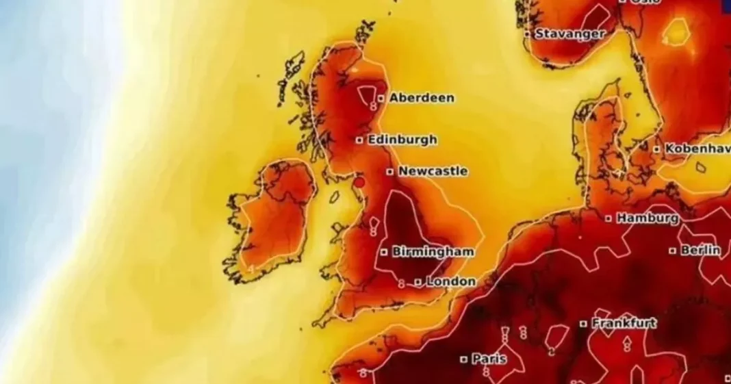
Britain is set for a ‘mini-heatwave’ soon with summer-like temperatures on the way – but not everyone will be basking in the warmth. New weather maps show an area of warm air sweeping into the UK just in time for the bank holiday on May 5.
The mercury is set to peak in East Anglia, where it is forecast to reach 22C, while people living in the southeast are also set to enjoy the heat, according to WXcharts. However, many other areas will miss out on the 72-hour hot spell around May Day, with temperatures stubbornly remaining in the mid-to-high teens.
Regions including Devon, Dorset, Somerset, Warwickshire, Worcestershire, Herefordshire, Shropshire, Staffordshire, Cheshire, Derbyshire, and North, West, East and South Yorkshire, are all predicted to miss out on the ‘mini heatwave‘.
The list goes on with Durham, Westmorland, Cumberland, Lancashire, Northumberland, Greater Manchester, Merseyside, and even the Isle of Wight being left untouched.
Forecast models from Netweather suggest highs of 22C could hit the southeast, while most of England could enjoy temperatures in the high teens.
According to one forecaster, there is still a chance of snow in parts of the UK this month, despite spring now being well underway.
James Madden from Exacta Weather: “The recent cooler and unsettled conditions of late could also have been a less potent version of what we were expecting for several days later and are now likely to be replaced with more of a high-pressure-influenced weather pattern… later next week (not perfect but definitely more settled and much warmer from later next week).”
“However, this does not dispel any further unsettled, cooler, and potentially wintry weather to follow on from these high-pressure-influenced weather conditions during early to mid-May, particularly across the north and Scotland in early May, and prior to something potentially much warmer to maybe even hot at times during the second half of May”.
Forecasters from the Met Office are predicting a new high pressure system to develop towards the end of April and into May, bringing more spells of settled, warm weather alongside some occasional heavy rain.
Their long-range forecast for Friday 25 April to Sunday 4 May reads: “Most likely dry and often bright across much of the UK at the start of this period, although more cloud, and some rain are possible across western areas.
“Little changes through the first weekend, although the chance of a few heavy showers increases across the south.
“Into the following week, it will most probably be high pressure dominated, with large amounts of fine weather, and perhaps the odd heavy shower, especially in the south.
“However, there is a small chance of an alternative scenario coming off, with cloudier and wetter weather more extensive, especially across the south and west of the UK.
“Winds are most likely to be light, with temperatures probably at or slightly above normal.”
At Reach and across our entities we and our partners use information collected through cookies and other identifiers from your device to improve experience on our site, analyse how it is used and to show personalised advertising. You can opt out of the sale or sharing of your data, at any time clicking the “Do Not Sell or Share my Data” button at the bottom of the webpage. Please note that your preferences are browser specific. Use of our website and any of our services represents your acceptance of the use of cookies and consent to the practices described in our Privacy Notice and Cookie Notice.


